Second Battle of Collierville
Appearance
It has been suggested that this article be merged with Battle of Collierville. (Discuss) Proposed since May 2024. |
This article includes a list of references, related reading, or external links, but its sources remain unclear because it lacks inline citations. (September 2022) |
| Battle of Collierville | |||||||
|---|---|---|---|---|---|---|---|
| Part of the Western Theater of the American Civil War | |||||||
 Collierville Battlefield | |||||||
| |||||||
| Belligerents | |||||||
|
|
| ||||||
| Commanders and leaders | |||||||
|
|
| ||||||
| Units involved | |||||||
| Third Cavalry Brigade | Chalmers cavalry division | ||||||
| Strength | |||||||
| 850 | 2,500 | ||||||
| Casualties and losses | |||||||
| 60 | 6 dead and 89 wounded or missing | ||||||
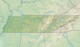
Location of Collierville in Tennessee | |||||||
The Second Battle of Collierville (November 3, 1863), also known as the Action at Collierville, was fought during the American Civil War between the United States (Union) and Confederate States. The fighting occurred during a demonstration on Collierville, Tennessee, by Brigadier-General James R. Chalmers, Confederate States Army.
Four minor battles occurred in 1863 in Shelby County during a three-month period. The two largest battles occurred on October 11 and November 3, 1863. The battle on October 11 was the largest land battle fought in the county.
Notes
[edit]![]() This article incorporates public domain material from Collierville. National Park Service. Retrieved September 12, 2022.
This article incorporates public domain material from Collierville. National Park Service. Retrieved September 12, 2022.
Further reading
[edit]- Rowland, Dunbar & Howell, H. Grady, Jr., "Military History of Mississippi, 1803-1898", Chickasaw Bayou Press, 2003, Library of Congress Number 2002117732
- Smith, Timothy B. (2012). James Z. George: Mississippi's Great Commoner. Jackson: University of Mississippi Press. ISBN 978-1-61703-231-8.

